Military Archaeology: Poisk.Pro Discovers Hidden Tunnels at the Arpad Line
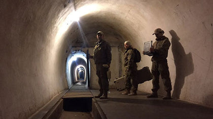
Detected with
OKM Rover C II New Edition (2009-2017)
Depth: 20.0 m (65.6 ft)
Region: Zakarpattya
Time of origin: 1939
Discovered by Poisk.Pro
As one of the most effective fortification systems during World War II, the Arpad Line and its bunker complex endured offensives despite the numerical superiority of the Russian army. After the Soviet troops outflanked the line and occupied Romania, the Hungarian forces finally retreated.
More than half a century later, the expert team from Ukraine, Poisk.Pro, has explored the area and the bunker complex to reveal what is still hidden underground and to rediscover what has been left behind in the facilities.
The Rediscovery of the Underground Tunnel System
Equipped with OKM Rover CII New Edition, the Poisk.Pro research team inspected a bunker complex at the Arpad Line in the Zakarpattya region. At the south side of the facility, the ground scanner detected an underground passageway in about 20 meters depth.
Not only inside the tunnel system, that is partilly open to tourists, but also on the hills, the georadars and ground scanners detected further hidden tunnels and entrances to the underground bunker complex. Its shafts are blocked by heavy metal hatches. Its main entrance is located on the west side.

The first of its two levels is located at a depth of approximately 20 to 30 meters. When following the tunnel, you reach the guardhouse after about 25 meters, after another 20 meters you find the infirmary with another hatch. From the medical station, a 150 meter corridor and 84 steps lead to the second level. Two exits to the surface connect the catacombs with the permanent fire positions. The lower level provides access to a tunnel in the direction of the village of Podpolozie.
Read more at poisk-pro.com

Historical Background: The Bunker System in World War II
The Arpad Line was the main line of defense located in the north-eastern Carpathian Mountains. Its bunkers and tunnels are a system of defensive works built between 1939 and 1944 to protect the borders of the former Kingdom of Hungary from Russia.
The mountain area offered the potential for effective defense: From the position of the bunker the army was able to control any movement along the highway Lviv–Budapest–Vienna. Moreover, regarding effectiveness per cost rate, the Arpad Line was one of the most effective fortification systems during World War II: cheaper construction, longer resistance as well as extremely low losses despite the enemy's numerical superiority.
Finally, at the end of 1944, after the Soviet occupation of Romania and the loss of Transylvania, the Hungarian forces retreated. Soviet troops outflanked the line by advancing along the Danube.
Its underground tunnel system links fortresses and fortifications like Uzhgorodsky, Mukachevo and Yasinyansky along the Russian Pass. Moreover, the complex comprised shelters, barracks as accommodation for soldiers, permanent fire positions, embrasure and anti-tank barriers, trenches and walls. According to reports, there are still weapons, ammunition and foodstuffs in the hidden tunnels.
The Explorers of the Bunker Complex
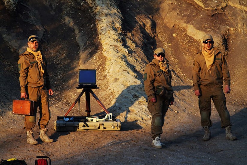
Poisk.Pro is a professional team of archaeological researchers and geophysicists who search for hidden objects and structures in depths up to 40 meters – in Ukraine and abroad. Moreover, Poisk.Pro organizes and conducts archaeological excavations, monitors underground communications and diagnostics and supports geotechnical engineers.
We find what you are looking for!

The crew is professionally equipped with georadars, ground scanners and further devices that are required for the efficient ground measurements for various use cases.
- Assistance in organizing and conducting archaeological excavations and prospecting, professional GPR research.
- Detection of iron and precious metal alloys in various types of soil and under water.
- Identification of voids of natural and artificial origin and examination of the walls and foundations of buildings.
- Diagnostics of soil stability state at the territories under construction and monitoring of engineering structures.
- Training and professional advice on working with geophysical equipment, georadars and scanners.
Poisk.Pro
+38 (097) 876 39 00
geopoisk.pro@gmail.com
Professional Tactics for Efficient Explorations
Preparation of the Exploration
The first step is to prepare the area for geophysical surveys in order to obtain accurate and meaningful measurement results. First, obstacles such as bushes, branches and tree trunks that could prevent a consistent measurement are removed from the scan field. Afterwards, the magnetometer is used to clear the scan field of uninteresting metal objects.
Since high-voltage power lines with their electromagnetic fields may falsify the measurements, the use of metal detectors and ground scanners in the immediate vicinity is not recommended. Scanning is also difficult after interventions in the ground and excavations, since these measures disturb the earth's natural magnetic field and the scanner can no longer locate the desired objects.

The Poisk.Pro team makes sure that all research projects are carried out only in compliance with the legislation in force.
Evaluation of Ground Measurements
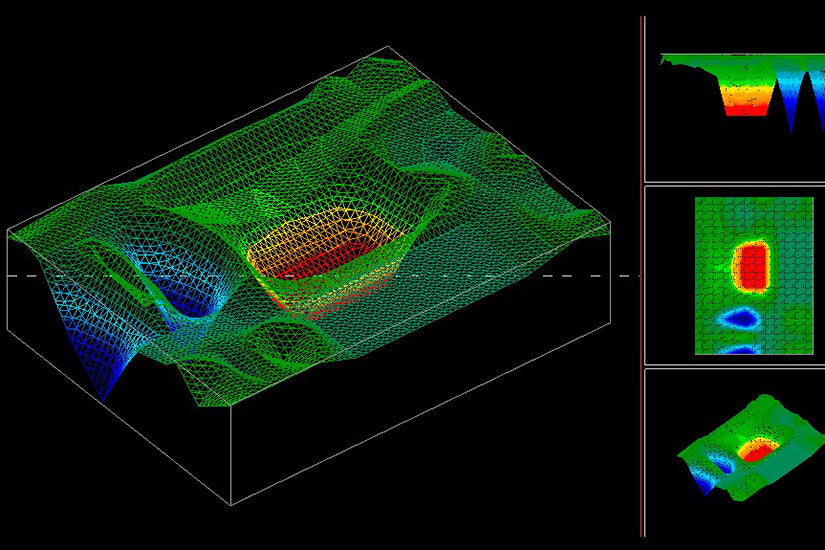
Ground scans with OKM detectors can be evaluated with the Visualizer 3D software. By displaying the measured values in different colors, ferromagnetic signals such as those of a metal box or pipelines (visualized in red) can be clearly identified. Cavities such as tunnels, underground rooms and wells (shown in blue) can also be detected. The visualizations allow to determine the position, size and depth of the detected structures.

All-round Equipment for Professional Research and Exploration
Poisk.Pro is equipped with ground measuring devices, drilling equipment, endoscope camera, professional navigation tools, climbing equipment and an inflatable boat for missions of all kinds, whether on land or under water. With this and further equipment, the expert team is ready for professional research and exploration in Ukraine and abroad.


Further Search Projects and Exploration
Poisk.Pro's focus is military archaeology, with the aim of finding treasures of the Third Reich and looted valuables from the World Wars.
In addition to these, further exciting search projects include explorations in a Catholic church: Georadar was used to locate and reveal underground burial sites and cavities.


Get Rewarded for Your Treasure Finds
You have also made discoveries and detected amazing artifacts and would like to share them (anonymously)? We look forward to reading and publishing your success stories!
