Cerro Gordo Ghost Town: Locating Unmarked Graves with GPR
Locating Unmarked Graves at Cerro Gordo: A Ground-Penetrating Radar Case Study
Some search areas come with a map. Cerro Gordo's cemetery came with almost none: a general location, no burial records, and more than a century of desert wind between the last funeral and the first real question about how many people were actually laid to rest there.
How the Project Began
Brent Underwood, the owner and full-time resident of the California ghost town of Cerro Gordo, got in touch with OKM Americas. He had been researching ground-penetrating radar equipment for a project on his own property and found the Gepard GPR 3D on okmdetectors.com.
The goal was clear from the start: locate the cemetery's unmarked graves. Its general position was already known, but not its true extent or how many people were actually buried there. Mark Harris of OKM Americas took the project on.

A Cemetery with More Questions Than Boundaries
Cerro Gordo was founded in 1865 as a silver mining town in California's Inyo Mountains. At its peak, around 4,000 miners worked its tunnels, and the mine's output was significant enough to help finance the early growth of Los Angeles. As local lore has it, the town even drew visitors like Mark Twain and Butch Cassidy in its boom years. Mining wound down by the 1940s, and the town sat largely abandoned until Brent bought it in 2018 and moved in permanently in 2020, documenting the restoration ever since on his YouTube channel, Ghost Town Living.
The cemetery is part of that history, and part of what Brent wants to preserve accurately. But more than a hundred years without upkeep leaves gaps no visual inspection can close: headstones shift, wood markers rot away, and a boundary that once made sense on the ground stops being obvious to anyone walking it today. Determining the real perimeter, without disturbing the ground itself, was the first priority.
A Second Target Underground
A second objective came up early on: locating the possible sites of old outhouses. Historic outhouse pits often preserve small everyday objects that never made it into any written record, which made them worth a look with the eXp 7000 Professional Plus alongside the Gepard GPR 3D.
What the Scans Turned Up
The cemetery survey delivered exactly what Brent needed: a fully determined perimeter. Combined with the spacing between the individual graves identified inside it, the team arrived at an estimate of around 60 people buried at the site — a number that didn't exist anywhere before this scan. Mark called it a genuinely big result for Brent's ongoing documentation of Cerro Gordo.


The outhouse search was more exploratory by nature. Of five candidate spots scanned with the eXp 7000 Professional Plus, one stood out with a promising signal — a solid lead worth a closer look.
The Technology Behind the Search
Ground-penetrating radar (GPR) sends radar signals downward and reads what bounces back. The Gepard GPR 3D turns those reflections into a color-coded, three-dimensional map of the subsurface — live on a tablet in the field, refined afterwards in OKM's Visualizer 3D Studio. Experienced users read position, depth, and size from that data. Rated for depths of up to 40 meters (132 ft), it's built for exactly this kind of one-person fieldwork. The eXp 7000 Professional Plus adds a dedicated cavity-detection mode — tailor-made for a small, shallow void like an old outhouse pit. Both devices are hand-built in Altenburg, Germany.
Cerro Gordo held two unanswered questions. Both got answered — without a single shovel touching the ground. You can watch it all unfold on Brent's own YouTube channel — watch it here ».

See What Ground-Penetrating Radar Can Uncover for You
From historic cemeteries to your own search area — the Gepard GPR 3D goes wherever the search takes you, with results you can read right in the field.
Discover the Gepard GPR 3DFAQ — Frequently Asked Questions About This Project
1. What is ground-penetrating radar (GPR) and how does it help locate unmarked graves?
GPR sends radar signals into the ground and reads how they bounce back. Changes in the reflection reveal disturbed soil, voids, or buried structures — including the outline and spacing of graves — without any digging.
2. How deep can the Gepard GPR 3D detect?
Under favorable ground conditions, the Gepard GPR 3D is rated for a maximum detection depth of up to 40 meters (132 ft).
3. Can this technology be used to search for other buried structures, like old outhouses or cellars?
Yes. Old outhouse pits typically leave behind a small void or a patch of disturbed soil — exactly the kind of feature a cavity-detection scan is built to reveal. That's why the eXp 7000 Professional Plus was used for this part of the search at Cerro Gordo.
4. I'm planning a similar historical or archaeological survey — where do I start?
Get in touch with OKM for a personal product consultation. We'll help you match the right device and scan mode to your specific site and goal, based on decades of field experience.
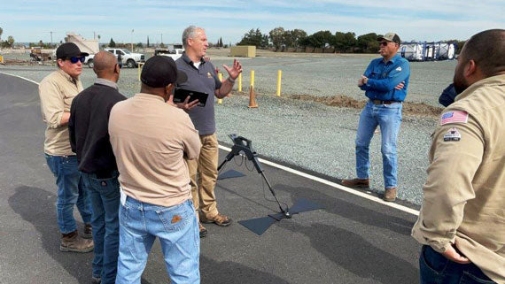
Field Training with OKM Americas: Gepard GPR in Action
In February 2025, OKM Americas visited a customer in Pittsburg, California, for a full-day training session. The goal was to show ...
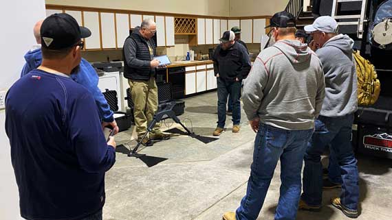
From Theory to Field: GPR Training in Extreme Weather
Frank Casser conducted a two-day training on the OKM Gepard GPR 3D in Greeley, Colorado, focusing on underground utility detection. ...

Paraguayan Police Relies on OKM Technology for Subsurface Detection
Paraguayan police use OKM GPR technology to detect underground structures.